Perfect Holiday: September 2010

Waterfalls

Waterfalls
Waterfalls are some of the best attractions of nature in Cameron Highlands

National Park

National Park
A Beacon Of Hope The Penang National Park

Jungle Trekking

Jungle Trekking
Hit the jungle trails early to avoid afternoon showers and to enjoys the rainforest in the warm sunshine

City

City
Ipoh was Malaysia's second city for administration purposes

Penang National Park

Thursday, September 16, 2010

A Beacon of Hope
The Penang National Park (Taman Negara Pulau Pinang) is one of the few natural
forested areas left on the island. It is also currently the world's smallest national
park.

The Park is located at the north-western corner of Penang Island, on what
resembles the side profile of a face, hence the name Muka Head (muka literally
means face).

With 1181 hectares of forest and 1381 hectares of wetlands, the Park's ecosystem
is a diversity of habitats with hills, sandy and rocky beaches, streams and coastal
forests - representing much of the natural habitats of Penang.

Way back in 1958, the Pantai Acheh Forest Reserve was first proposed as a nature
conservation area by a group called the "Committee for the Preservation of Natural
Beauty". Since that time, both nature interest groups and even government reports
have proposed that the Reserve be turned into some kind of park and conservation
area. The Malaysian Nature Society (MNS) made several representations to the
state and federal governments to turn Pantai Acheh into a national park.

It was on 4 April 2003 when Pantai Acheh Forest Reserve was finally declared the
Penang National Park by the then deputy Prime Minister Datuk Seri Abdullah Ahmad
Badawi.

The Penang National Park is the first protected area legally gazetted under the
National Park Act of 1980, signifying the State and Federal Governments' efforts in
protecting the environment. It goes without saying that funds will be allocated to
develop the Penang National Park, within guidelines. All logging activities stopped
since 1996. Part of the Pantai Acheh Forest Reserve had been logged before 1955;
none have been logged since.


The Park is unique as it contains several different types of habitat including a
meromictic lake, wetlands, mangroves, mudflats, coral reefs and turtle nesting
beaches.

A survey conducted by the MNS, together with Universiti Sains Malaysia (USM)
indicated a reasonable rich fauna. Small mammals such as tree shrews (tupai glis),
slow loris, flying lemur (Cynocephalus variegates), civet cats, lepoard cats, sea
otters and pangolins have been spotted. If you're lucky, some of these shy
creatures make an occasional appearance at Pantai Keracut, where the meromictic
lake is located.

Besides mammals, the Park is also home to many birds, reptiles, amphibians and of
course the famous turtles, especially the Green turtles (Chelonia mydas), the Ridley
turtles (Lepidochelys olivacea), the Leatherback turtles and the Hawksbill turtles
(Eretmochelys imbricate).

When you are at the Park, look up and see if you can spot a Brahminy Kite,
White-bellied Sea-eagle or the Crested Serpent-eagle that are commonly seen
soaring gracefully above.

If you come across any snakes along your path, you would be happy to know that
most of the snakes at the Park are non-poisonous. However, take note that there is
no sure way to tell a poisonous from a non-poisonous snake, thus it is best to keep
your distance from them.

Did you know that spiders, scorpions, centipedes and millipedes belong to the same
group - Arthropada? They are, however, from different classes. Keep an eye out for
these little creatures along your hiking trail. Insects, by far, are the most numerous
denizens of the Park.

The flora at the Park is one which is characteristic of the coastal dipterocarp (or
winged seeds) forest. 'Wings' help seeds to have a better chance of being blown far
from the parent. Some trees from the Dipterocarp family are Chengal, Meranti
Seraya, Jelutong, Gaharu and Bintangor. When cultivated, these trees provide
valuable and aesthetic hardwood. Other plants that populate the Park include ferns,
palms, pitcher plants, meromictic flora, climbers, fungi and mangrove.

There are altogether an estimated 417 flora and 143 fauna species, according to a
local daily report in May 2006.


Facilities at the Park 
Penang National Park only receives daily visitors. For camping, visitors are requested
to seek permission from the management. Camping and weekend programmes
organised by the National Park are also available for students who are interested in
this activity. However, accommodation is not provided in the National Park. Visitors
are recommended to stay at the nearest hotels around Batu Ferringhi and Teluk
Bahang.

Visitors are also reminded the deposit their litter in the 'monkey-proof' trash bins
where one has to push a leaver to open the hatch. The bins are located along
popular hiking trails. Remember, pick nothing up (except rubbish!) and leave nothing
behind.

Rest stops equipped with picnic tables are also strategically placed throughout the
Park for your enjoyment.
 

Penang National Park offers vast opportunities for research, education, recreation
and ecotourism activities such as climbing, trekking, swimming, wildlife observation
or simply enjoying the natural environment, which is a combination of the forest and
sea.

Rich in biodiversity and wildlife, the park has attracted world-renowned scientists,
researchers and even the National Geographic crew to study and learn from its
pristine surroundings. In this pocket of undisturbed natural beauty, we must learn to
appreciate the natural heritage and help to promote their conservation for future
generations.

Lang Tengah Island

Lang Tengah Island (Pulau  Lang Tengah)

Lang Tengah Island (Pulau Lang Tengah)
Lang Tengah Island or Pulau Lang Tengah off the coast of Terengganu is one of the nation's well-kept secrets. Its arresting beauty can easily captivate you while you are there. Crystal clear sea-water, pristine beaches and untouched tropical jungle. Its arresting beauty lingers forever in your memory. An island you can call your own, private and tranquil.

Lang 
Tengah Island (Pulau  Lang Tengah)
Take a stroll along the whitewashed, sandy beaches or bath in the sun for that coveted golden tan. Explore the wonders of nature, and you'll be surprised of what you'll discover. Whatever you do, we'll make sure that your stay with us is an enjoyable one.

Pulau Redang

THE white sandy beach, crystal clear water and picturesque scene made me fall in love with Redang island. I was touched by the glory of nature on the island, surrounded by the coconut trees.
It was an unforgettable trip. We stayed at Redang Beach Resort, did all the standard activities and mingled with other guests. At night, we enjoyed the barbecue, walked along the beach and sat on the rock enjoying the night scene. Snorkelling was most enjoyable. Since it was our first experience, there was initial fear which was overcome by curiosity. It was totally delightful to see corals, sea cucumber and colourful fish like reef shark, blue spotted stingray and clown fish.
The best was when the fish bit my finger and swam all around me. It was wonderful. This was my first trip to the island and definitely won't be the last!
Redang is just like the Perhentian a Marine Park. It's located 45 km off the coast of KualaTerengganu is the largest of the group of islands dotting the South China Sea off the Terengganu coast. The island offers crystal clear waters and numerous dive sites for the enthusiast. Sheltered within the Pulau Redang Marine Park, the waters here abound with marine life.
Redang Archipelago exists of  9 islands that abound with marvelous marine fishes, turtles and coral reefs that ensure great snorkeling and scuba-diving.
The boat trip starts from the fishing village of Merang. This is a fishing village North of Kuala Terengganu. You can get there by bus. The boat trip takes about 40 minutes. Most of the boats depart for Redang and return before noon. Each resort has its own boat transfer schedule. This may change and is dependent on the tide, sea and weather conditions.
The best time to visit Redang is between April and October. Take note that most resorts are closed during the North-east Monsoon, which blows from November to March.

Kapas Island

apas Island answers to all your hopes for an idyllic tropical island – swaying palm trees, untouched jungle, turquoise water gently lapping at the beach and colourful coral reefs just off the shore.

This picturesque getaway is less than 5 km from the mainland and is reached within 15 minutes by speedboat from the coastal fishing village of Marang. Its accessibility from the mainland makes it popular with locals for daytrips and the fairly good availability of budget accommodation means that it is also popular with backpackers.
The resorts on Kapas Island are mostly spread out over three beaches on the western shore, facing the mainland. Accommodation here ranges from dorm rooms to moderately priced air-conditioned chalets.  More luxurious accommodation is available on Gemia Island, a small islet just a few hundred metres northwest of Kapas.

Pulau Kapas means Cotton Island in Malay and this peculiar name is attributed to the pure white beaches that are the trademark of this island. The name comes as no surprise once you have walked along these beaches: the sand is soft and white and slopes gently into the crystal clear water.
Another reason why Kapas Island is popular is because of the excellent snorkelling in the waters surrounding the island. There is an abundance of corals and other marine life, visibility is good and the water is shallow and calm. Because the coral is mainly around the rocky edges of the island, you can still go swimming off the beautiful beaches, even at low tide.

Kapas Island may be easy to reach, but it is much harder to leave this island after being immersed in its beauty.

Tioman Islands

DISCOVER TIOMAN
line

Like a giant sleeping dragon, the dark green ridges of Tioman Island rise up above the waters of the South China Sea. On closer inspection, it becomes clear that the dragon’s dark green scales are in fact giant trees and impenetrable jungle; that the grey claws are giant granite boulders and that the dragon’s horns are twin peaks with smooth, straight cliffs, surrounded with swirls of mist.

The dragon-like appearance of Tioman Island is at the root of a legend surrounding its origin: A dragon princess from China was flying to her prince in Singapore and stopped to rest in these calm, warm waters. Enamoured by the beauty of the area, and the waves lapping at her sides, she discontinued her journey and took the form of an island.

The natural beauty of the island is its biggest attraction. Lush tropical jungle covers about 12,000 hectares of the island and countless mountain streams and waterfalls sustain the many protected species of mammals and birds. The waters around the island are filled with corals of all shapes and colours and home to a vast diversity of sea creatures, including two species of marine turtle. There are a few excellent beaches on Tioman, and these curves of golden sand are usually tucked away at the edges of villages or fronting one of the many resorts.

Tioman has options for every kind of holiday-maker: families with small children, honeymooners, scuba divers, backpackers, adventurers and even those looking for a slice of exclusivity and luxury. Most places to stay are clustered around the villages that are dotted along Tioman’s coastline while there are a few small resorts that are built around private beach coves.

Tioman is the largest in a volcanic group of islands off the east coast of peninsular Malaysia. Getting there is simple as there is both a ferry service from Mersing on the mainland and an airport on the island itself.

Tioman is a beautiful, popular and affordable holiday destination so book ahead!

Pulau Langkawi

Langkawi comprises a group of 99 tropical islands lying off the north-western coast of Peninsular Malaysia, about 30km from Kuala Perlis and 51 km from Kuala Kedah on the mainland. The main island is popularly known as Pulau Langkawi. The islands are blessed with an intriguing heritage of fabulous myths and legends of ogres and gigantic birds, warriors and fairy princesses, battles and romance.
As a natural paradise, the islands are perhaps unmatched anywhere else in Southeast Asia. With a geological history dating back 500 million odd years, the islands contain unique rock formations that stir the imagination and baffle the mind. Numerous caves, with their stunning stalactites and stalagmites, taunt the adventurous to unravel their ancient secrets.
Fine beaches offer sun-filled days of complete relaxation. The clear emerald waters around the islands provide numeours opportunities for a host of water sports and recreational activities. The enchanting marine life beneath the waters of Langkawi's islands also beckon diving enthusiasts.

Pulau Pinang

The island was referred to as Bīnláng Yù (檳榔嶼, 槟榔屿) in the navigational drawings used by Admiral Zheng He of Ming-dynasty China in his expeditions to the South Seas in the 15th century. Early Malays called it Pulau Ka-Satu or "First Island".
The name "Penang" comes from the modern Malay name Pulau Pinang, which means island of the areca nut palm (Areca catechu, family Palmae). The name Penang can refer either to the island of Penang or the state of Penang. The capital of Penang state is George Town. More specifically, George Town is also called Tanjung in Malay. Penang Island is simply Pulau Pinang and Penang state is Negeri Pulau Pinang in Malay. Although the state is called Penang in English, it's official name is actually the state's Malay name, Pulau Pinang. This is because the Malay name is always used in governmental letters and also the Malaysian identity card, MyKad.
Penang is severally known as "The Pearl of the Orient", "东方花园" and "Pulau Pinang Pulau Mutiara" (Penang Island of Pearls). Nowadays, due to short messaging, Penang is also referred as "PG" or "PP" in Malay.[2]

Gua musang


Legend

It was believed that long ago this town was inhabited by some superstitious hunters who made offerings of animals in front of the cave of Bukit Gua Musang. One afternoon a raging storm broke out and the huts of the hunters were destroyed. At the height of the storm a bolt of lightning struck the summit of the hill and nearly split it in two. The hunters, believing that the God of the Cave was angry with them, knelt down and began to pray. As they were praying they saw a huge pack of foxes (or musang in Malay) running into the cave. At once, they seized their bows and arrows and lay in wait for the foxes. They waited the whole evening but the foxes did not emerge, not even when the storm had stopped. From then on, the inhabitants called the cave Gua Musang.
A month after this strange event, seven young hunters climbed the hill but only one came back alive. He told the villagers that when he and his six companions were halfway up the hill, a length of stone staircase appeared before them. They climbed the staircase and upon reaching the summit they found a tree, under which, stood a bowl of pure water. The young men, with the exception of one, drank the water in the bowl to quench their thirst. Before the others could persuade him to drink, the bowl vanished. They grew afraid and quickly began to descend. Suddenly a blood-chilling cry was heard. The hunter turned quickly but it was too late! His six friends had disappeared from sight. He rushed down the slope but there was no sign of any dead bodies at the bottom of the hill.
He concluded that the "God of the Cave" had taken his friends and had spared him because he had not drunk the water in the bowl. Most of the villagers did not believe the young man's story. They were sure that the other six must have slipped and fallen, but the bodies of the missing hunters were never found.

Places of interest

Gua Musang is the northern gateway to Taman Negara (National Park), which is situated in the southeastern part of Gua Musang district. The untouched tropical rainforest in Taman Negara is among the oldest in the world. It is well known for its biodiversity and is home to many endangered species of animals and plants.
Gua Musang is surrounded by limestone hills and caves, which have become popular with cavers and rock climbers.
The small village of Merapoh in Pahang which is just south of Gua Musang serves as a popular starting point for those who want to scale Gunung Tahan.
Another interesting place to visit in Gua Musang is a Buddhist temple in Pulai, which is purportedly 400 years old.
Nenggiri River is a favourite among those who enjoy river rafting. There is also a rafting race, called Nenggiri Challenge. Archaeological sites can be found in caves, such as Gua Cha, Chawan and Jaya, which are situated along the river.

MAPS CAMERON

JIM THOMPSOM IN CAMERON

"On Easter Day, 1967, American businessman and founder of the modern Thai silk industry James H.W. Thompson disappeared while supposedly on a stroll in the jungle-clad Cameron Highlands, central Malaysia." Thus runs the blurb of William Warren's compelling and even eerie book Jim Thompson: The Unsolved Mystery, which appears to be the definitive account of the man's life and the theories swirling around his presumed death. The main ones are that Thompson a) got lost in the jungle, b) was abducted for reasons of ransom or politics, or c) committed suicide. Unfortunately none of these theories has a shred of evidence to substantiate it; Thompson might just as well have vanished into thin air, and his disappearance holds much the same fascination for idle people of Bangkok as does the JFK assassination for idle people everywhere.

Cactus Valley

Castus Valley

Castus Valley
Cactus Valley is one of the biggest and most popular tourist destination located at the cool mountains of Brinchang, Cameron Highlands.
Cactus Valley boast of having one of the most variety of cactus plants, some as old as 60 years. Hydroponics mehod of cultivating crops such as tomatoes, strawberry and others are being practiced.
Castus Valley
Cactus Valley also have the most comprehensive variety of plants and foliage including roses, calla lily impatiens, fuchsia, ananas/vriesea, camellia, hibiscus, rhododendron, bird of paradise, glory bush, clivia miniata, peaches, hippeastrum, geranium, coleus, gerbera, oncidium and many other. 8 varieties of apple trees, passion fruit plants are also cultivated in Cactus Valley. Cactus, fresh strawberry, potted plants, souvenir items and dried flowers are available for sale at Cactus Valley. Your visit to Cactus Valley will be one of the most wonderful experience in your life.

Rose Centre

Roses are another Cameron Highland's product that is able only to be grown in cool climate. Therefore, if you are in Cameron Highlands, never miss out paying a visit to the rose garden. There are two rose gardens in Cameron Highlands for visit - Rose Valley and Rose Centre.

All visitors are allowed to wander into the farms and gardens. You will be able to see many varieties of roses in all shapes and sizes. You will be able to see black rose, green rose and thornless rose plants. Besides roses, carnation, rare orchids, fushias, chrysanthemums, lily, gerbera, diamond, lady shoe, honeysuckle, camelia, gipsy and many more are also displayed in these rose gardens.

Inside Rose Centre, they have a landscaped gardens. Rose Centre has a glorious hilltop view. The view is perfectly beautiful. Besides that, they have dramatic sculptures. It is something that you should never miss out. These sculptures are outstanding and it is definitely good for photography.

The best time to pay a visit to these rose farms and gardens are during August - September. This is because flower festival is occasionally held during that time. All the highlands growers and local business communities will come to the highland to decorate their motorized floats. These motorized floats are then parade through the town.

Butterfly Farm

At 1,500 meters above sea level, Cameron Highlands is home to a number of birds and insects not found in the lowlands. A selection of the unusual butterflies, moths and insects indigenous to the area can be found at butterfly farms in the Green Cow area.

There are two butterfly farms in Cameron Highlands and the are both located around the Kea Farm (Green Cow) area. They are situated not far from Kea Farm, along the way down hill to Tringkap. Both of the farms are just a short walking distance away from each other.

Get a change to see many different species of butterflies which used to be a common sight in the highlands many years ago. A walk through an enclosed area where each species of butterfly is happily floating around in a lush, plant-filled garden is the highlight.

Cameron Highlands Butterfly Farm

The Butterfly Farm located 5 km north of Brinchang, which open daily from 9 am - 6 pm. Butterfly Farm is nice to visit not so much for the butterflies as the variety is limited but perhaps more for the other insects such as the leaf insects, rhinoceros beetles and even reptiles. Located in Kea Farm. The entrance fee is RM3 for adult and RM1.50 for children.

Cameron Highlands Butterfly Garden

Butterfly Garden is another butterfly farm with almost the same display of insects and reptiles but they have quite a collection of cactus on sale in their shop. Various species of butterflies and live insects can be found here. It also has a small bonsai garden and souvenier shop. This farm is located around Kea Farm area too. It opens from 9.00am to 6.00pm daily. The entrance fee is RM3 for adult and RM1.50 for children.

Raja Brooke butterfly

In Butterfly farms, there's one special species, the Raja Brooke butterfly (Troides Brookiana), is famous for its black and shimmering teeth-shaped electric green markings on its wings. This beautiful butterfly was discovered by the naturalist Alfred R. Wallace in 1855, and was named it for Sir James Brooke, the Rajah of Sarawak. It's considered a rare species, and therefore is protected by the endangered species act.

Moreover, the Raja Brooke butterfly is one the national butterfly of Malaysia . It originally belongs to Papillonidae butterfly family. They considered as a strong fliers with three fully developed pairs of legs. Furthermore, these types of butterfly can only be found from the tropics to more temperate regions.

Even though, visitors can buy the Raja Brooke butterfly from the souvenir shop, however, visitors are not allowed to take out of the country due to the law prohibiting in export of endangered species. Of course, visitors are allowed to bring other beautiful butterflies. Therefore, visitors can hang out in the butterfly souvenir shop and take a look around, to see whether you want to take back framed preserved butterfly as a decoration.

Refflesia

It lives as a parasite on the Tetrastigma vine, which grows only in primary (undisturbed) rainforests. Rafflesia lacks any observable leaves, stems or even roots, yet is still considered a vascular plant. Similar to fungi, individuals grow as thread-like strands of tissue completely embedded within and in intimate contact with surrounding host cells from which nutrients and water are obtained. Perhaps the only part of Rafflesia that is identifiable as distinctly plant-like are the flowers; although, even these are unusual since they attain massive proportions, have a reddish-brown coloration and stink of rotting flesh, which is why it was nicknamed the "corpse flower". This scent attracts insects such as flies which then pollinate the rare plant. It is not to be confused with the Titan Arum, Amorphophallus titanum, which is also commonly referred to as the "corpse flower".

Rafflesia arnoldii is rare and fairly hard to locate. It is especially difficult to locate the flower in forests as the buds take many months to develop and the flower lasts for just a few days. The flowers are unisexual and thus proximity of male and female flowers is vital for successful pollination. These factors make successful pollination a rare event.

How many of these plants still survive is unknown, but as the remaining primary forests of Borneo and Sumatra disappear, it can only be assumed that their numbers are dwindling. Many are known to be nearing extinction. Some environmentalists are thinking of a way to recreate the species' environment, in an effort to stimulate a recovery in the population of this endangered species. This has proved unsuccessful so far, but the efforts have continued. Steps are also being taken to conserve the forests of Sumatra and Borneo.

Please contact local campanies to visit rafflesia flower because only 4WD can through the destination.

Facts About Rafflesia

* Rafflesia is the largest individual flower. Titan arum bears the largest inflorescence.

* Rafflesia is a parasite which attaches itself to a host plant, Tetrastigma vine, which grows only in undisturbed rainforests, to obtain water and nutrients.

* The genus Rafflesia is named after adventurer and founder of the British colony of Singapore, Sir Stamford Raffles.

* Dr Arnold is remembered in the species name as Rafflesia arnoldii.

* Rafflesia is the official state flower of Sabah in Malaysia, as well as for the Surat Thani Province, Thailand.

* Rafflesia manillana, the smallest species in the genus Rafflesia is also has 20 cm diameter flowers.

* Rafflesia flowers are unisexual.

* Forest mammals and tree shrews feed on Rafflesia fruit which is 15cm in diameter, filled with smooth flesh and thousands of tiny hard coated seeds.

* It is believed that rafflesia is related to poinsettias, violets, passionflowers, and other members of the order Malpighiales.

* The rotten smell of the flower is due to the reddish tentacle-like, branched ramentae, inside the corolla of petals.

* Rafflesia is an endangered or threatened genus.

* Rafflesia arnoldii does not have chlorophyll, as all the green plants have and so it cannot undergo photosynthesis.

Jungle trekking

meron Highlands: Jungle Trekking Trails

Cameron Highlands Cameron Highlands Cameron Highlands Cameron Highlands

Hit the jungle trails early to avoid afternoon showers and to enjoy the rainforest in the warm sunshine. Please take heed of the field notes to determine the best trail to hike depending on your fitness, time available and possible wildlife and plant sightings. Enjoy the variety of Cameron Highlands trails to explore the the special ecology of the highlands.


TrailsRating
Field Notes
Trail 1ToughA climb up to Gunung Brinchang (2032 meters) starting north of Brinchang town; over 1-hour walk up with another hour walk back on road; alternatively drive to summit and walk down Trail 1; another option is to trek back and forth on part of the dense mossy forest ridge trail to Gunung Irau (2090 meters) that takes 3-4 hours one-way; all trails not well marked; use a guide.
Trail 2ToughNeed to be fit and prepared for this 1.5 hour up and down walk over rough terrain; not well marked and merges with Trail 3 for a longer trek; starts in Brinchang at Sam Poh Buddhist Temple
Trail 3Moderate to ToughStarts at Arcadia Cottage near the golf course; a 2.5 hour steep climb to Gunung Beremban (1841 meters); shorter alternate paths to Trail 2 and Trail 5; longer treks join Trail 7 or Trail 8 from atop the mountain (allow 2 more hours)
Trail 4EasyA 30-minute stroll to Parit Waterfall, the path is paved in stretches with a turnoff to the watchtower; start near the Forestry Department
Trail 5Easy to ModerateA 1-hour walk over wooded terrain that merges with Trail 3 to split off towards Gunung Beremban or to Arcadia Cottage, with the option to shift to Trail 2 to Sam Poh Temple; start at MARDI (Malaysian Agriculture Research and Development Institute)
Trail 6Moderate to ToughA poorly marked and confusing path that starts at Bharat Tea Estate road, continues along ridge and merges with Trail 10 at Gunung Jasar summit (1670 meters); 2.5 hours but easy to get lost so use a guide; do not be confused by another Trail 6 runs short from Parit Waterfall to join Trail 5
Trail 7Very ToughA 2-hour haul starting from MARDI with a steep ascent to Gunung Beremban on overgrown path; descend from the top on Trail 3 (recommended) or hike down Trail 8 for another 2-3 hour adventure
Trail 8Very ToughA difficult 3-hour climb starting from Robinson Waterfall to Gunung Beremban
Trail 9ModerateA 1-hour hike down from Robinson Waterfall to the power station following pipeline on a slightly steep descent with some difficult scrambling; alternatively walk down Trail 9A and return up via this path (2 hours) or take a local bus back to Tanah Rata.
Trail 9AModerateLess steep than Trail 9 along a gradual path that exits near vegetable farms and the Boh Tea Plantation road after 1.5 to 2 hours; alternatively walk up Trail 9 behind the power station or take a local bus back to Tanah Rata
Trails 10, 11 and 12Moderate to ToughAn arduous climb up to Gunung Jasar, the path starts near Oly Apartments and continues towards Gunung Perdah (1551 meters); to avoid the summit splinter off to Trail 11 along a parallel path to Gunung Perdah where both trails merge with Trail 12 to the weather station near the golf course road; unclear on markings and time estimates; Trail 12 also leads down to exit out of the Orang Asli village with a walk back by road or straight back via Dahlia Villa
Trail 13ModerateStart behind Cameronian Holiday Inn for a 1.5 hour walk with a stream that merges with Trail 14
Trail 14ModerateA good day hike to experience enclosed, mossy forests on way to Gunung Mentigi (1535 meters) before exiting on the Tanah Rata road; return via local bus; may need a guide and can last up to 4 hours


Cameron Highlands: Jungle Trail Map

Study the Cameron Highlands trail map to find the starting points and exits for the various trails. Not all trails are marked well and it does get confusing at times. Have an alternative plan to exit early or head back the same way in case of bad weather or time constraints.


Cameron Highlands


Cameron Highlands: Wild Species And Wild Photos

Cameron Highlands Cameron Highlands Pitcher Plant Cameron Highlands

All of the Cameron Highlands trails are good for brisk morning walks and great exercise outdoors. Try approaching jungle trekking by taking it slow and easy to enjoy the nice little surprises hidden in the montane rainforest.
On each trail you can find interesting plants and animals or observe rainforest birds or beautiful orchids. Take a pair of binoculars or a camera and linger among the fungi, mossy forest and monkeys to capture a glimpse of these diverse habitats.


Trail


Wild Features & Photography Options
Trail 1highest peak G. Brinchang; excellent mossy forest; pitcher plants, orchids, fungi; birdwatching
Trail 2birdwatching; small stream; millipedes; moss, pitcher plants, orchids
Trail 3vistas of Tanah Rata; monkeys; birdwatching; gingers
Trail 4steep trail to watchtower with panoramic views; ferns, gingers
Trail 5secondary forest; stream; snakes, millipedes; bird's nest fern, palms
Trail 6scenery of G. Jasar; Orang Asli village
Trail 7secondary forest; rattan, ferns, orchids, palms
Trail 8Robinson Waterfall; forest scenery
Trail 9birdwatching; lizards; frogs; squirrels; Robinson Waterfall; fungi, ferns, orchids, gingers, lianas
Trail 10, 11, 12panoramic views; Orang Asli village; butterflies; flowers, wild pepper
Trail 13small river; tree ferns; mossy forest
Trail 14mossy forest; lianas; historical war remnants

Asli People @ village

Wednesday, September 15, 2010

The Orang Asli are the indigenous people who dwell in the forest of Peninsular Malaysia. The name is Malay for, literally, "original people", and is a collective term to denote the 18 sub-ethnic groups generally classified as Negrito, Senoi and Proto-Malay. In the Orang Asli census of 1997 number them around 105,000 people. 
Orang Asli can be found in many different parts of Malaysia, and their choice of lifestyle is dependent of where they dwell. The Orang Laut, Orang Seletar and Mah Meri live along the coast and are fishermen. The Temuan, Jakun and Semai have taken to agriculture, some even manage to own rubber, oil palm and cocoa plantations. Still, about 40% of the Orang Asli population continue to be forest dwellers. They cultivate hill rice, and engage in hunting and gathering, and trade in forest produce such as petai, durian, rattan and resins. The forest dwellers include the Semai, Temiar, Che Wong, Jah Hut, Semelai and Semoq Beri. A small number continue a nomadic lifestyle deep in the rainforest. This includes Negrito groups such as the Jahai and Lanoh.

It is incorrect to assume that the Orang Asli live isolated and cut off from out outside world. Economic dealings with the communities on the fringes of the forest has been going on for hundreds of years, especially between the Proto-Malay groups with the neighbouring Malay communities. They traded their forest produce for salt, knives, metal axe-heads, among others.

The Orang Asli Today

Visitors hoping to see orang asli in "forest attire" is certainly in for grand disappointment. Yes, they wear modern clothes too. And they would appreciate it a lot if visitors come with used clothes which they can use. As far as appearance goes, they look Malay. Naturally there is a difference between the Orang Asli and the Malays that tell them apart. The majority are stoutl their features are rugged and their height is by average lower than the Malays.

Visits to Orang Asli villages deep in the forest of Cameron Highlands is now available. These are arranged with the ecological guides, who will provide the necessary information on these people, and at the same time, educate visitors on the forest planst and herbs. 
Orang Asli would appreciate it if you bring along a donation of used clothing. The photographs in this gallery are taken from our ecology trip with AsiaExplorers members made to visit the Orang Asli.

IPOH

Ipoh developed into one of Malaysia's main cities due to the booming tin mining industry around the turn of the 19th century. During the British colonial era, Ipoh was Malaysia's second city for administration purposes. There are several notable buildings from the British Colonial era such as the railway station and the town hall. The population of Ipoh is about 70% of Chinese origin These days Ipoh is perhaps best known for its excellent restaurants, hawkers, and famous local dishes.


LOCATION:
The city of Ipoh is located about 200 km north of Kuala Lumpur. Journey through the 
North South Expressway (NSE or PLUS Highway) takes a breezy 2 1/2 hours through 
scenic rolling valleys, palm oil plantations and limestone hills of Peninsula Malaysia. 
Distances from other major cities: Penang (2 hours), Johor Bharu (6 hours),
Singapore (6 1/2 hours) and Kuantan (5 hours).

DESCRIPTION:
A city rich in history, Ipoh often conjures the images of laid-back municipality 
intertwined with old-world charms and gastronomic delights even to the most 
persnickety types. The equally historic Kinta River (Sungai Kinta) cuts across 
the city, subliminally divides the locality into the much fabled Ipoh Old Town 
and New Town. In general, the city jurisdiction covers other smaller towns as 
well, namely Chemor, Jelapang, 
Falim (or Farlim), Menglembu, Tanjong Rambutan, Silibin, Manjoi, Simpang Pulai,
Bercham, Tambun, Gunung Rapat,
Sungai Rokam, Pasir Puteh, Lahat, Pengkalan, etc.

The city is administered by Majlis Bandaraya Ipoh, or (un)affectionately 
known as MBI by its citizens. The city, to some level, was founded 
by Sir Frank Swettenham, a British colonial resident, in 1893 when the Ipoh 
Sanitary Board was formed. In 1962, it was upgraded to Majlis 
Perbandaran Ipoh, a municipal status, before it was accorded a city 
status in 1988 where the current Ipoh City Council takes reign of the city administration.

It is often said that Ipoh was the third municipality to be accorded a city status, 
after Kuala Lumpur (1974) and Penang (1957 by the Queen Elizabeth II, when the 
Federation of Malaya was still under the British colonialism). Yet, in reality, Penang 
(or Georgetown to be exact) was never an official city in present-day status. 
In fact, in 1976, the so-called City Council of Georgetown was reorganised to become 

the current Majlis Perbandaran Pulau Pinang (or Penang Municipal Council). Hence, by
going on the technicalities of this somewhat trivial information, Ipoh is really the 
second municipality to be accorded a city status in Malaysia (whew, can't believe
I spent a whole paragraph on this!).

What is today a city covering an area of 643 sq km started as a sleepy hollow on 
the banks of Kinta River before the tin (or locally known as bijih timah) was 
discovered in the Kinta Valley. The implosion of growth of the city due to the mining i
ndustry was probably comparable to that witnessed by Kuala Lumpur (with the 
discovery of bijih timah in the Klang Valley). I found an interesting excerpt from 
Wikipedia that best summarises the effect of tin mining industry to the city
(which I dubbed as the "tin rush" area):
 
However, from the turn of the 20th century when more British tin-mining 
companies were set up in the city, Ipoh gained prominence. Influential 
institutions like The Chartered Bank of India, Australia and China Ltd
opened a significant office in Ipoh in 1902. It provided credit to the  
Straits Trading Company and later the Eastern Smelting Company.
More colonial era firms such as Botly and Co., A.H Whittaker & Co.,
Chartered Accounts, Evatt & Co., and Estate Visiting Agents Milne & 
Stevens started to set up offices in the boom town. Its geographic 
location in the rich tin-bearing valley of the Kinta River made it a 
natural growth centre. It grew rapidly as a mining town, especially 
in 1920s and 1930s
Sadly, the growth of Ipoh, once dubbed as "City of Millionaires" and
"The Town that Tin built" was severely stunted when the tin prices 

collapsed in the 1970s and 1980s. The tin mines were closed and 
various local and foreign companies cease their operations. The remnant
of the industry can still be seen today in the outskirts of the city, i
n places like Kampar, Pusing, Lahat and Gopeng. Today, the large 
tract of mining lakes is converted into other use, such as duck rearing, 
fish breeding, recreational parks and even fruit farming (after 
extensive land rehabilitation, I reckon). A number of tin dredges 
have also been advertised as a tourist attraction, though in reality,
not many people visit those.


Nonetheless, natural urban growth still takes place in the city. Being 

the administrative capital for the state of Perak, Ipoh has not really died 
a slow death. While the city is not known for state-of-the-art commercial
towers or the hippest night joints, time has allowed to the city to re-discover i
ts own character as a laid-back town with visibly no traffic jams or 
occasional flash floods. In fact, Ipoh is often regarded as one of the 


cleanest city in the country (apart from the impressive city of Kuching in Sarawak). 

Many residents will swear by the slower pace of life in the city, apart from the
best white coffee, mouth-watering pomelos (limau bali or limau tambun) and hor
fun which are treasured by people from all walks of life.

While Ipoh is not so much known for her tourist attractions, I managed to write
a number of articles on the sights in and around the city which probably worth 
a weekend stopover:


PULAU PANGKOR

Off the coast of perak State, north of Selangor , lies a cluster of fabulous islands with unquestionably some of the best coves and beaches on the western coast of peninsular Malaysia. Among them, two islands predominate in terms of accessibility, infrastructure and development - the largest island, Pangkor and her sister Pangkor Laut. Those who are not familiar with the geographical locations generally confuse the two. Forty minutes by ferry from Lumut, the popular island resort of Pulau Pangkor (Pangkor Island) welcomes visitors with its serene golden beaches, crystalline blue waters, and cool refreshing breezes. Located about 90km south west of lpoh, it is largely inhabited by fisherfolk.
They live in scattered fishing settlements along the coast especially on the eastern side, facing the town of Lumut and Teluk Batik, and their catch comprises mainly cuttlefish and anchovy. The modern facilities make it an ideal gateway. A wide range of sun and sea activities are available such as scuba diving, wind-surfing, fishing, snorkelling.

PULAU PERHENTIAN

The Perhentian Islands (Pulau Perhentian in Malay) lie approximately 10 nautical miles (19 km) offshore the coast of northeastern Malaysia in the state of Terengganu, approximately 40 miles (64 km) south of the Thai border.

South Beach, Perhentian Besar
The two main islands are Perhentian Besar ("Big Perhentian") and Perhentian Kecil ("Small Perhentian"). The small, uninhabited islands of Susu Dara (Virgin Milk), Serenggeh and Rawa lie off Kecil. The Perhentians belong to Pulau Redang National Marine Park, which means that fishing, collecting coral and littering are strictly prohibited. Like Besut, people here generally speak Kelantanese Malay.
Sheer beauty of Pulau Perhentian makes it the destination of tourists. Both the islands have palm-fringed white sandy beaches and turquoise blue sea. One can have a number of activities on its beaches and forests. Scuba-diving, snorkeling, and swimming are the most popular tourist activities here. On most beaches, the water is shallow with lots of rays, cuttlefish and parrotfish. For diving, there are dozens of divesites around both main islands, as well as several off-shore sites. Apart from these, you could also enjoy activities like camping, canoeing, fishing, jungle trekking, and banana boat riding. As for accommodation, most of it can be found on Perhentian Besar, the larger island. Hotels are usually aimed at budget travelers.
Tourism is the base of economic activity in Perhentian. However, owing to the Islands' protected status, the main tourist activities are minimal in environmental impact: sunbathing, snorkeling, scuba diving, and turtle and shark-watching.
Summer 2007, 2 wind turbines have been installed, still not connected to the network in October 2008, Thus the island's electrical power is still provided by diesel generators. A third turbine is being built. Electricity is 24-hour during high season. Fresh water is provided by springs. In this respect, the Perhentian Islands are prized by tourists as an 'escape' from the modern world.
As the state of Terengganu follows Islamic customs, the consumption of alcohol and wearing of immodest clothing are discouraged. In order not to offend local inhabitants, tourists are advised to consume alcohol discreetly and to wear one-piece bathing costumes. No penalties are imposed on tourists for 'breaches' of the local customs, however.

KUALA TAHAN

Taman Negara National Park was established in Malaysia in 1938/1939 as the King George V National Park. It was renamed to Taman Negara after independence, which literally means "national park" in Malay. Taman Negara (total area 4,343 km²) has a reputation as the world's oldest tropical rainforest.
Taman Negara encompasses three states, Pahang, Kelantan and Terengganu, each with its own legislation. The Taman Negara Enactment (Pahang) No. 2 of 1939 is enforced in the state of Pahang, the Taman Negara Enactment (Kelantan) No. 14 of 1938 in the state of Kelantan and the Taman Negara Enactment (Terengganu) No. 6 of 1939 in the state of Terengganu. The enactments have similar contents.
Taman Negara Pahang is the largest at 2,477 km², followed by Taman Negara Kelantan at 1,043 km² and Taman Negara Terengganu at 853 km².
The park has been developed into a famous ecotourism destination in Malaysia. There are several geological and biological attractions in the park. Gunung Tahan is the highest point of the Malay Peninsula; climbers can use Kuala Tahan or Merapoh as their departure point. Taman Negara is the home of some rare mammals, such as the Indochinese Tiger, Crab-eating macaque, Sumatran Rhinoceros, Great Argus, Red Junglefowl, Malayan Gaur (seladang) and Asian Elephant. Among the birdlife, the rare Malayan Peacock-pheasant is still found here in some numbers. Tahan River has been preserved to protect the Malaysian mahseer (ikan kelah in Malay), a type of game fish.
Others attractions found near Kuala Tahan (Park headquarters for Pahang) include a canopy walkway, Gua Telinga (cave system), Lata Berkoh (rapid). Visitors can enjoy the tropical rain forest, birdwatching or jungle trekking (e.g. Tenor Rentis) and the river views along the Tahan River.
All visitors to the park must get permits from the Department of Wildlife and National Parks. There are many hostels and hotels nearby.

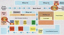
Our Location


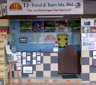
We Are   : TJ Nur Travel & Tours
Address : No.68A, Persiaran Camellia 3,
                    Bandar Baru Juta Villa,
                    39000 Tanah Rata.
                    Cameron Highlands.
                    Pahang Darul Makmur.
                    Malaysia.

Phone    : 012 - 910 8111 (WAN)
                 : 013 - 939 3757 (AHMAD)
                 : 014 - 254 7357 (AHMAD)

Fax          :   05 - 491 4142
Email       : TJ_Nur@yahoo.com

Our Location

Tuesday, September 14, 2010

Coming To Cameron HIghlands

 
Perfect Holiday by TNB | Template Provided by Blogger Templates